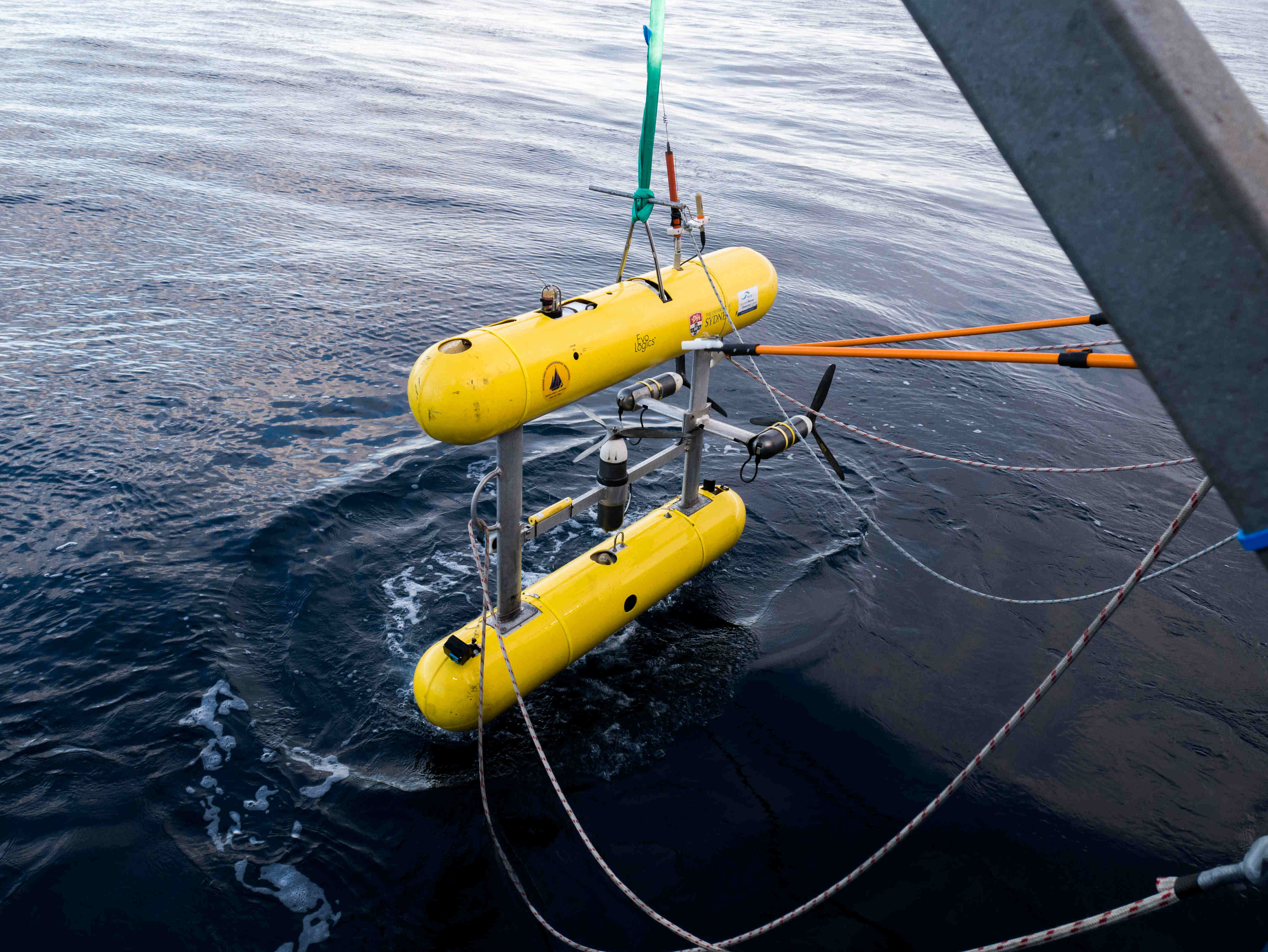
Scientists have used high-tech underwater robots to take a closer look at the deep offshore reefs on the east coast of Bruny Island, revealing the seabed biodiversity there for the first time.
More than 61,000 images of three reef systems in Storm Bay were collected at depths of 30 to 60 metres, using an Autonomous Underwater Vehicle (AUV).

"The imagery we captured has given us an initial understanding of the seabed biodiversity across these deep offshore reefs, and an inventory that provides an important baseline for tracking how that biodiversity changes over time," said IMAS marine ecologist Ms Ashlee Bastiaansen, who is the lead author of the study.
"We observed a general decline in the overall diversity of organisms on these deep reefs between 2015 and 2020."
Ms Ashlee Bastiaansen noted that the images indicate seaweed cover dominates the shallower depths of the Storm Bay reefs, and sponges, corals and other seabed animals are more prevalent below 40 metres.
"We also found that the green macroalgae Caulerpa, which is a feature of reef tops at depths of 30 metres in this area, had become shallower and reduced in cover over this period," Ms Bastiaansen said.
"This is important because changes in the distribution and abundance of key species like Caulerpa can indicate shifts in ecosystem health and function, potentially affecting the broader reef community and its resilience to environmental changes."
IMAS Project Lead and co-author Associate Professor Neville Barrett said these deep reefs were relatively inaccessible, so were not well studied.

"Yet they host high levels of biodiversity and important commercial and recreational fishery values," he said.
"With the increasing human pressures on coastal regions, including nutrient inputs from cities and recent offshore aquaculture developments, baseline studies like this are vital for monitoring and managing the health of deep reef ecosystems."
The images and annotations from the work are hosted on the Intergrated Marine Observing System (IMOS) SQUIDLE+ online platform, which offers a permanent, publicly accessible baseline for monitoring the ecosystems in Storm Bay.
"This baseline data provides an essential foundation for evidence-based management plans for Storm Bay," Ms Bastiaansen said.
"While the work described in this paper is based on two time points, the true value of these publicly accessible images and baseline annotations will become apparent over time."


